REMETEA - A DESCPRITION
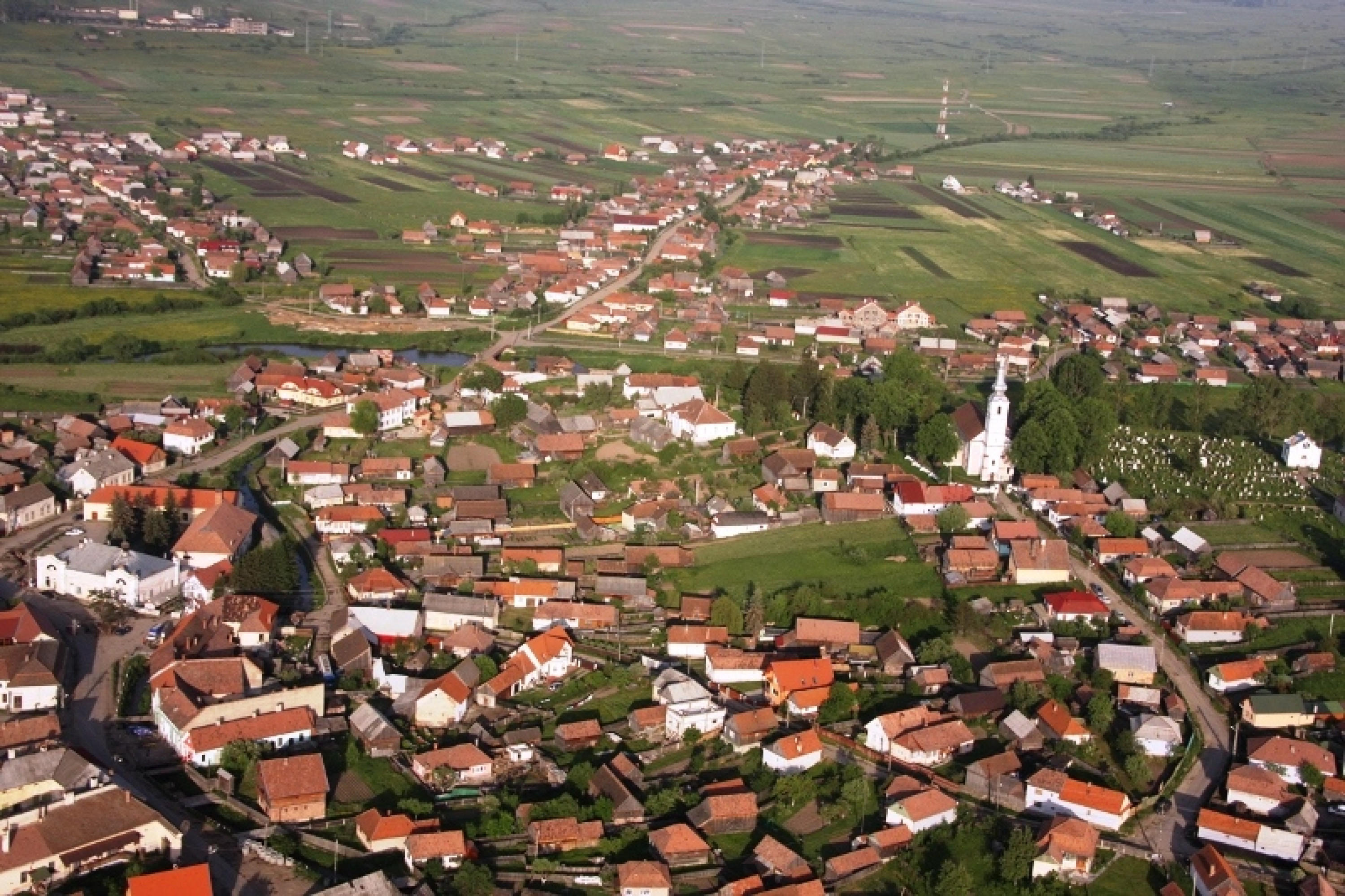
Remetea is a large village in the north-west of the Gheorgheni basin, 75 kilometres from Miercurea-Ciuc and 15 kilometres from Gheorgheni. You can take the Brașov-Târgu Mureș train service and get off at Ditrău station, from where the centre of Remetea is at a distance of just 2 kilometres. By car, you drive to the centre of Ditrău on the E578 European highway, coming either from the direction of Gheorgheni or Toplița. You then turn westwards, and Remetea is at a distance of 4 kilometres. In the middle of the nineteenth century, talking about the village, Balázs Orbán said, “Remetea has existed since long ago, and sits facing Ditrău on the left, higher bank of the Mureș, in the valley of the Kőpatak stream”. The village is lying at the foot of the Gurghiu volcanic mountains, at an average altitude of 750 metres above sea level. According to the 2011 census, the population is 6,171, the large majority being ethnic Hungarians of Roman Catholic confession. The total surface area of the village is 10,774 hectares, of which the village itself covers 1,145 hectares. Remetea and the villages around it typically have long cold winters and short summers. The average annual temperature is between 5.1 and 5.5 degrees Celsius. There are several kindergartens and schools in Remetea, as well as doctor’s offices, dentist’s surgeries, pharmacies, a post office, a bank and various food retailers and other categories of shops. There is also a tourist information office, a hairdresser’s, a beauty parlour, a vehicle service centre, a petrol station and a guest-house. There are also timber processing plants and seven joiner’s workshops.
Natural conditions / Climate and landscape
Its natural conditions are shaped by the distinctive forms of the intermontane basins. The flat area formed by the alluvium of the Mureș (Maros) is followed westward by rolling hills cut by stream valleys, which in turn give way to the volcanic mountains of the Görgény (Gurghiu) range. The Gurghiu was formed by Neogene volcanism. Its main rock is andesite. Arriving in the commune one is immediately greeted by the splendid peaks of the Northern Gurghiu visible from Remetea: Kereszthegy (1,517 m), Kecskekő (1,483 m), Öreghegy or Bătrîna (1,634 m), which are the highest parts of the crater rim of the extinct Fancsal volcano.
Climate
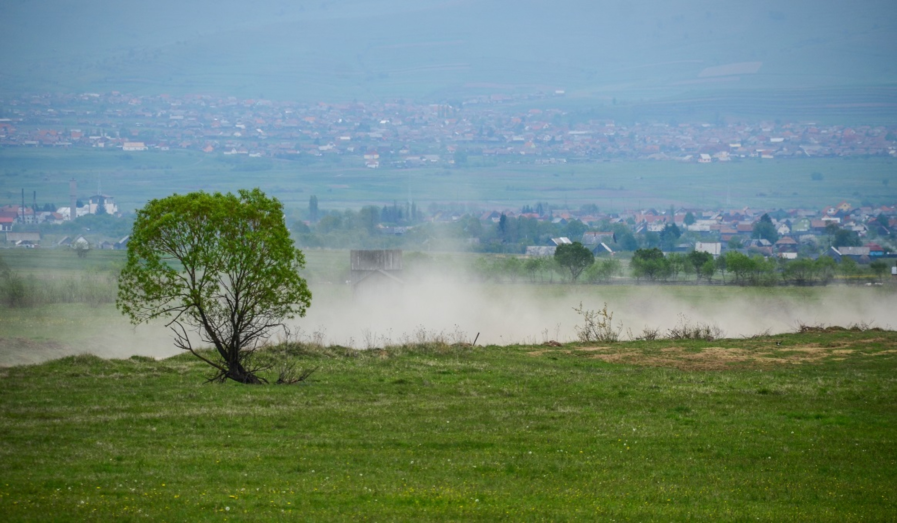
The climate is typical of settlements in intermontane basins: long, cold winters and short but relatively warm summers. The mean annual temperature is 5.1–5.5 °C. Annual sunshine duration is 1,600–1,700 hours. Relative humidity is high; from October to early summer it can exceed 80%, and even in July it is at least 70%. Consequently, fog forms quickly and tends to persist.
The average number of clear (sunny) days per year is scarcely 80, while frost days may reach up to 160. Late spring frosts are frequent, sometimes even in June. Early autumn frosts can already occur in early September. This is, however, compensated by a long, sunny autumn.
Average annual precipitation is about 600 mm. Calm wind conditions occur 55–60% of the time, rising to about 70% in December and January.
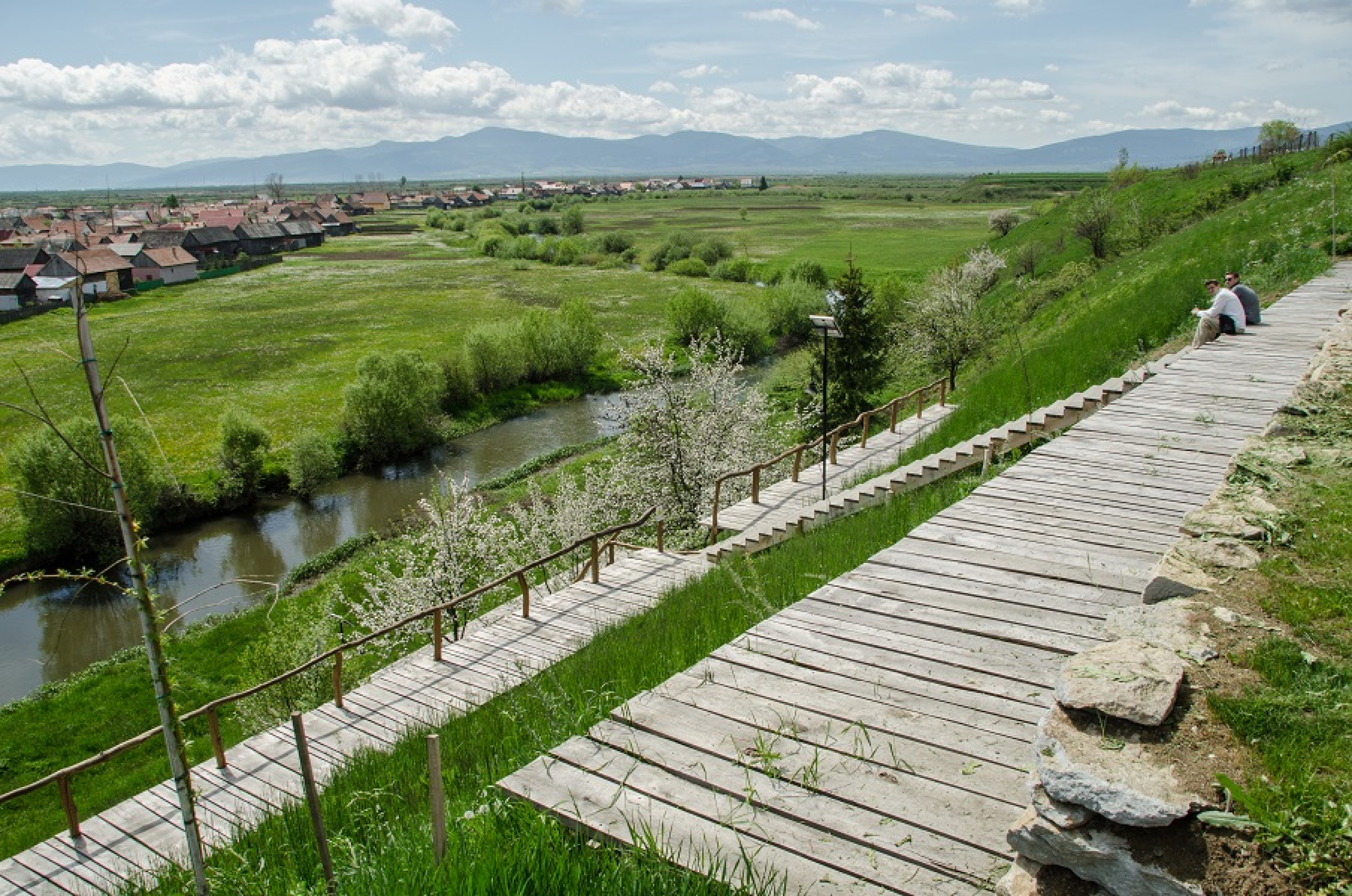
Across Remete flows Transylvania’s longest river, the Mureș. Its total length is 803 km, of which 768 km are in Romania; in Harghita County it runs for a stretch of 80 km. The name is of Celtic origin: “muor” = marsh and “acha” = river, i.e. “moraha” = marsh river. It arrives from the south and, making large meanders, leaves the village to the north. In the inhabited area the streams that flow into the Mureș are: from the west the Kőpataka (which also crosses the commune centre), and the Sineu stream that collects the waters of the Veszes and Kecskekő streams. The Martonka stream was the life-giving water of the Martonka hamlet, which was depopulated in the 1970s. From the east the Ghiduț and Ditrău streams augment the Mureș’s discharge.
Access
By car: from Gheorgheni or Toplița via European route 578 (former DH12). From Ditrău centre turn west on the county road 153C and after about 4 km you reach the commune centre, where parking is available and the local tourist office can provide information.
By rail: take scheduled passenger trains on the Brașov–Târgu Mureș line to Ditrău; from the Ditrău station it is about 2 km to the centre of Remetea. Express trains stop at Gheorgheni station, from where you can continue to the village (18 km north) by taxi, by local scheduled bus, or by a passenger train to Ditrău.
Form of the settlement
The shape and structure of the commune were determined primarily by the Mureș, the heights on its left bank, and the Kőpataka stream.
The settlement’s nucleus was the Church Hill above the Mureș, called Bánya by locals. This is supported by frequent floods of the Mureș, the defensive possibilities and the proximity of former forests. Next came settlement along the lower course of the Kőpataka and the ridge above it, today called Bakó.
From the second half of the 18th century the village had already taken on the character of a nucleated (clustered) settlement. Inner streets and dispersed hamlets developed. In 1751 a place called “tul’a Maros Felül” is mentioned, which may correspond to today’s Borvíz or Fürdő street neighbourhood. In 1773 the names of the three parts Fenek, Tolvajos and Alszeg appear; in the same year the sawmills of the Eszenyői Lázár serfs on the Sineu stream are mentioned.
Animal husbandry and the use of stream waters shaped the dispersed hamlets of the village. In the Sineu stream valley the homonymous neighbourhood developed, where sawmills, flour mills and wool fulling and washing installations were established. In the first half of the 20th century as many as 18 flour mills were already in operation. North of the commune the dispersed settlements Kicsibükk (11 km) and Martonka (6 km) emerged; both were depopulated in the 1970–1980s due to rural-depopulation policies.
From the 1830s a settlement called Csutakfalva formed in the upper reaches of the Kőpataka as a result of forest clearance — as the name suggests. Its upper part was populated after the great fire of 1892.
For a long time the commune’s administrative centre was on the Hadnagy Hill mentioned earlier. At the end of the 19th century the present Centre formed around the market square, shaped by imposing buildings erected by Armenians and by the Székely Puskás family; part of the population still calls that area the Market.
In more recent times the establishment of the Milk Powder Factory played a significant role in shaping the appearance of the Alszeg quarter.
Parts of the settlement
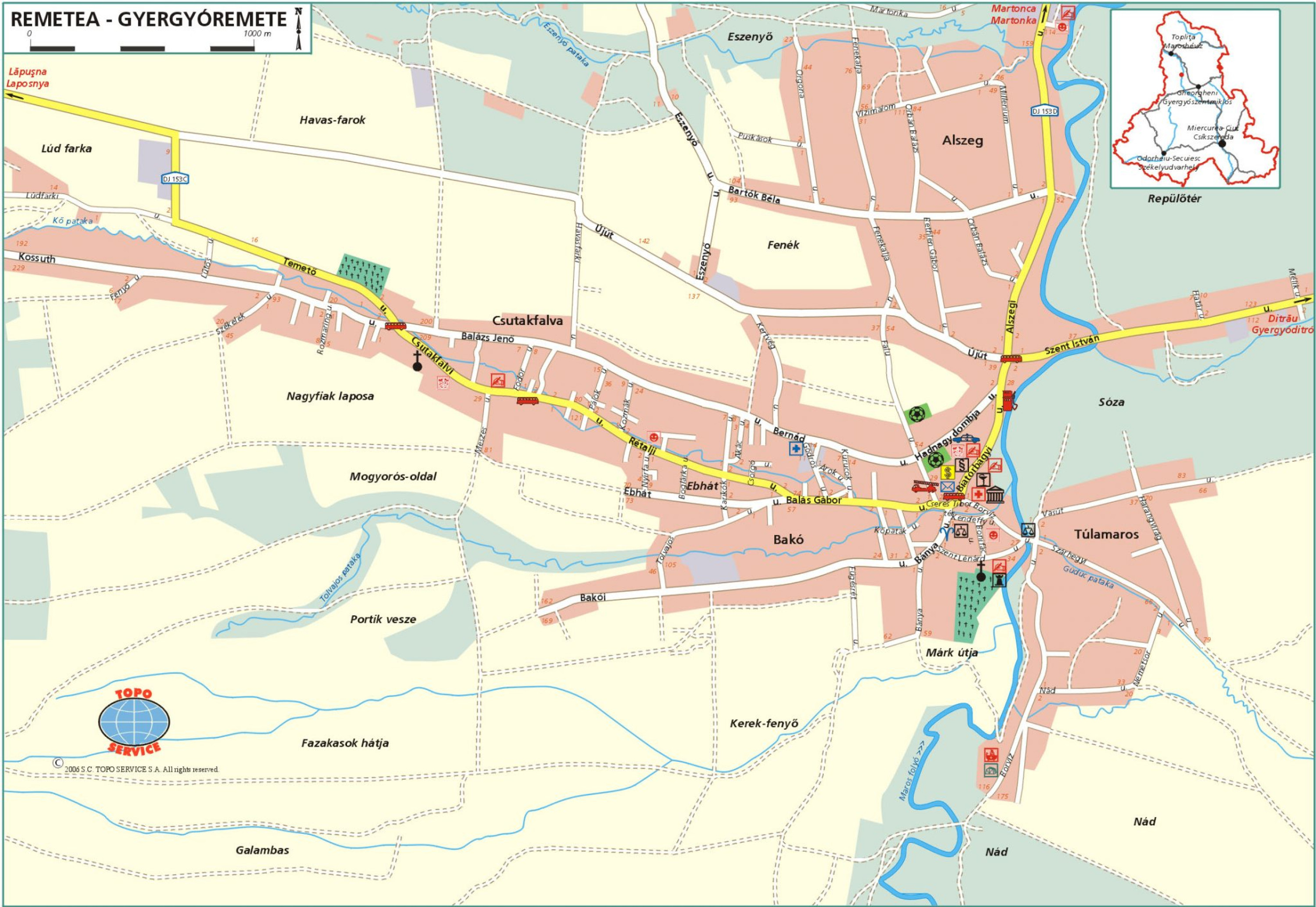
From a geographical point of view, the commune — which today has 5,953 inhabitants — is divided into the following parts:
-
Centre: the Church Hill (Templom-domb, Bánya) and the lower course of the Kőpataka
-
Túlamaros: on the right-bank plain of the Mureș, structured by three streets
-
Rétalja: along the middle course of the Kőpataka; upper part and the road up to Kőláb: Csutakfalva
-
On the right-side ridge of the Kőpataka: Bakó, Ebhát, Tolvajos; on the left side: Bernát–Külső Út
-
The stretch of Mureș from the junction of the road leading to Ditrău and the area bounded by the Sineu stream: the many-streeted Alszeg and Fenékalja
-
Sineu: along the Sineu stream
The names of the settlement and border parts have changed little over the centuries; at most the economic use of the areas has changed — arable, hay meadow, pasture, forest or built-up area.
Chronology of local place-names (evolution of lieu-dit names)
(The abbreviations in parentheses are explained as follows: e = forest, l = pasture, k = hay meadow, sz = arable land.)
-
1720: Lórez (e) is mentioned, and in its vicinity (in vicinitate) to the east the Laczkók Csere forest.
-
1751: “Alsó Forduló Határon alól a Dudád pataka túl Várhegy allya” (e).
-
1770: Marton stream in the boundary of Alsó Forduló.
-
1773: Mentions around Alszeg: the bridge on the Mureș, under the church in Alszeg, in the Vak road.
Felsőforduló: Kaliba oldala (sz), Hegyesbükk (sz), Kőpatak or pataka (sz), Sarokoldala (sz), Sarok allya (k), Nagy Keresztfa (sz), Hegyeskő (sz), Tolvajos pataka (sz), Kaliba (sz), Kis Mihály magasa (sz), Fenekre menő (sz), Fenek (sz, l), Fenyő- or Sineu hill (sz), Nagykút (sz), Dudád (sz), Kormos kő (sz), Szállapos (sz, k), Pallóramenő at Nagy Keresztfa (sz), Kis Keresztfa (sz), Égető fa (sz), Kicsind (e), Kerek fenyő (k), Méhes patak (sz, l), Bogáros (sz), Simon malma (sz), Veresmart (sz), Köves domb (sz), Bogáros szorossa (sz), Nyírszeg, Emberfő, Kecskekő. The latter is shared with Lăzarea but has been used by the people of Remetea for six years. A sawmill on the Sineu stream is mentioned at this time.
-
1864: According to notes of judge Balás Elek and clerk Nagy Ádám, Remetea’s boundary names include: Pallóra menő (road to Palló), the most fertile arable, Sarok (sz), Sarokalja (k), Alsó Márk útja, Varga well (k), Kerek fenyő (sz), Miklós- and Papháza (sz), Hideg patak (k), Román, birch forest and hay meadow, Csutakos (sz, k), Laczkók hátja (sz), Vereserdő (k, e), Gergely vesze (wooded, stony place), Galambos (e, k, l), Agyagásdó, side of the Bükk road, Mátyás vesze, Farkasok hátja, house of Nagy András, Karikadomb — all meadows and arable fields. Fügésrét (k), Általfekvő, Ebhát, Magyarós side — hilly arable fields. Tolvajos pataka, Lető, Bükk road, Kaliba side, Nagyfiak laposa (sz), Laposbükk, Antal’s field, Pál András vesze, Czines, Portik vesze köze (sz, k), Málnavész (sz), Hegyesbükk (e, k), Szászok vesze (sz, k), Rókabükk — shrubby place, Kelenc kő — rocky, shrubby place, Kisújhavas (e, k), Kereszthegy (e, k), Bakta (e, k), Punga field — mostly forest, Sároshíd (k), Katalina (e), Kecskekő (e), Hegyes Emberfő, Batrina havasa (l, e), Ploptis, Gălăuțaș, Fülpe — belong to Subcetate but are also used by the people of Remetea. Fagyecel — shrubby, stony place, Farkasmező (k), Kánás pataka, Romlás (sz, k, e), Dudád, Kőhát (sz), Cseresznyés (k), Későfészek (k, sz), Későfészekalja or Nagy Kút — muddy hay meadow, Sineu hill (sz), Lukács vesze, Két patak köze, Kicsi bükk, Dávidok field (k, sz), Verespatak top, Erőssé, Rományé (k), Eszenyőbükk, Magashegy (e), Gúzsvesszős, Nyírfő, Lúdfarka — bushy birch meadows; Fenekalja, Alsó Szállapos (sz, k), Fenektető, Veresgödör, Rétalja.
The above list of place-names can be supplemented with later names or with the names of boundary parcels associated with the commune, for example: Pálkovács, Sóza, Csortán ere, Havas farka, Csorgó, Román eleje, Román farka, Csög, Mélik tanya, Korondié, Nád, Lok, Két patak orra, Újerdő tető, Limbus, Dregus.
Their names refer to former owners (e.g. Fazakasok hátja), landform (Kőhát, Hegyes), springs or waterways (Csortán ere, Csorgó), characteristics of local flora and fauna (Galambas, Bükk, Juharos), or spatial-geographic relations (Alsó Forduló, Felső Forduló, Román eleje).