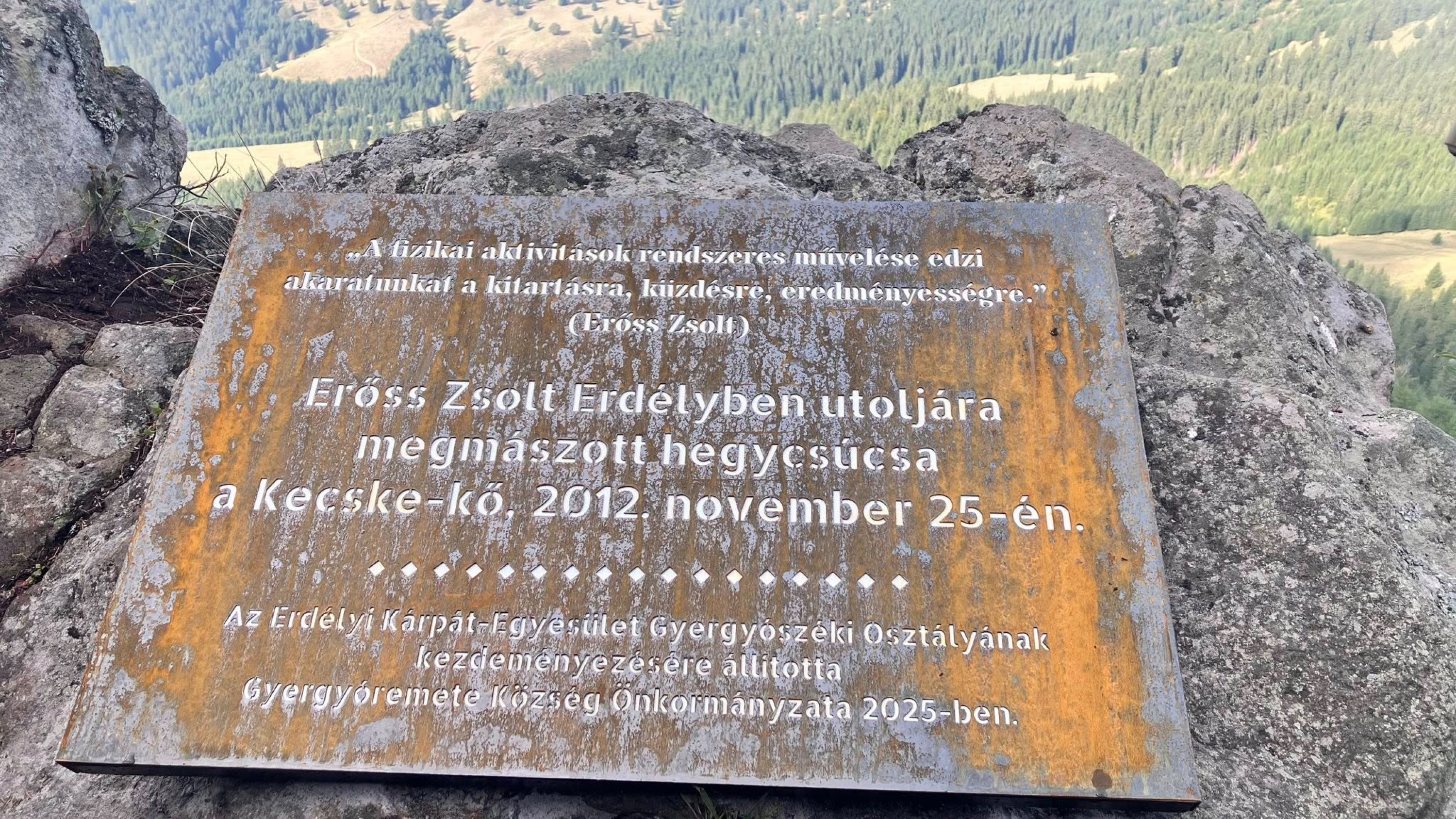
Erőss Zsolt Memorial Plaque
Filming with Hazajáró on Kecske-kő and Kereszthegy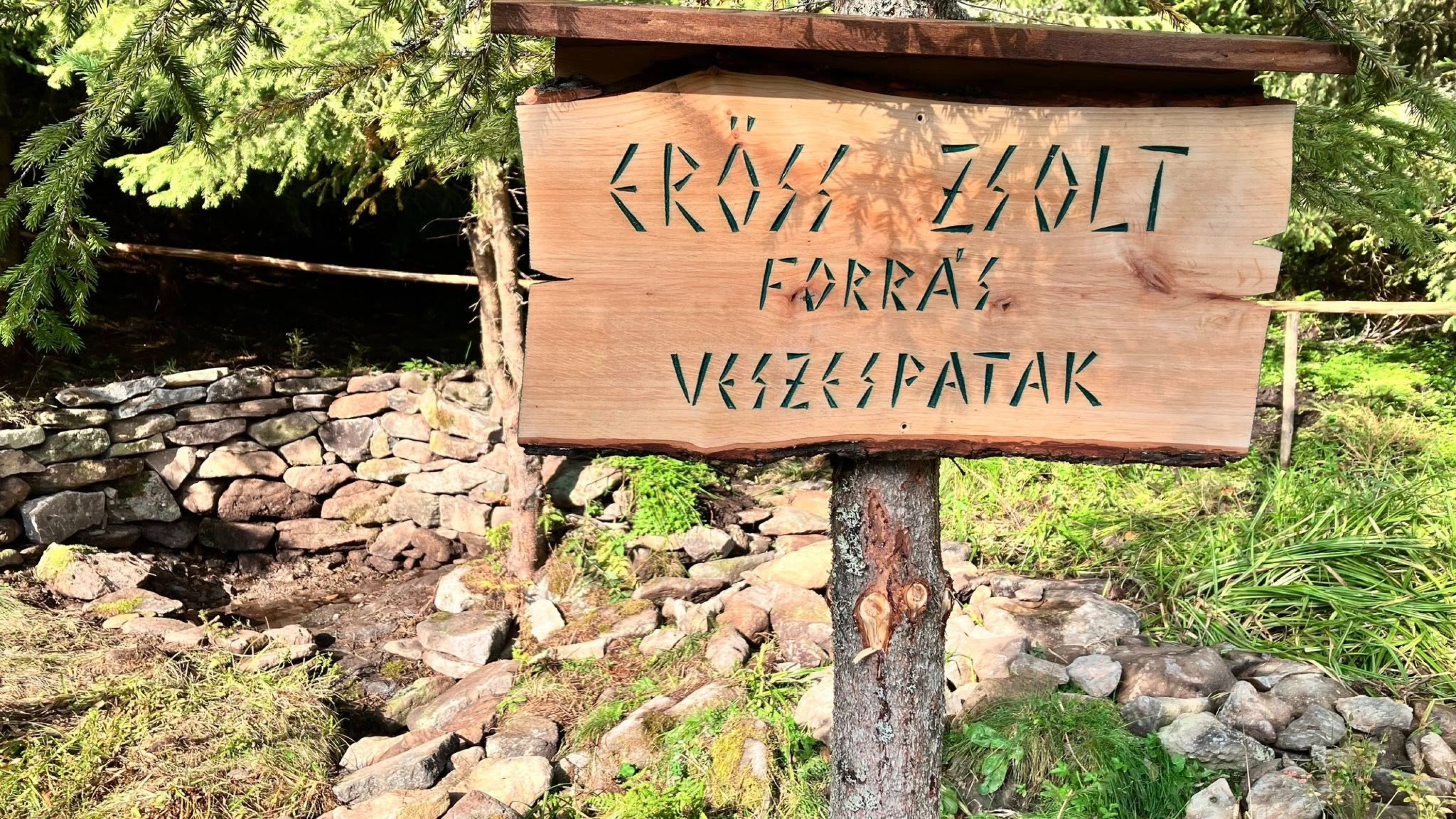
On September 14 the team of the popular Hungarian public-broadcasting travel magazine Hazajáró filmed material for an episode about the Upper Mureș defile and the North Gurghiu Mountains. During the shoot they visited the Kecske-kő and Kereszthegy peaks near our commune. The team was accompanied by myself and by István Ferencz, who has roots in Remetea and frequently visits the area.
On this occasion a memorial plaque to Zsolt Erőss was produced and installed on the Kecske-kő crag as a tribute from our commune to the mountaineer from Gheorgheni who tragically died in the Himalayas 12 years ago. Kecske-kő was in fact the last Transylvanian summit he climbed, on 25 November 2012. Also for this occasion the spring of the Veszes stream, which rises under Kecske-kő and now bears Erőss Zsolt’s name, was tastefully developed.
Thanks for these achievements are due to the Remetea local government, in particular the mayor and deputy mayor, and to carpenter Endre György, who made the nameplate placed in front of the spring. Thanks are also owed to several municipal employees and volunteers who worked on landscaping the spring and its surroundings.
The plaque and the spring, reachable via a newly formed hiking trail, will contribute to the development of Remetea’s tourism — let us take care of them!
The segment filmed here will be broadcast during October on the public broadcaster’s TV channels and on Hazajáró’s video-sharing channel. The ceremonial unveiling of the plaque and the spring will take place on 31 May 2026, the day after the 11th Erőss Zsolt endurance hike.
Laczkó-Szentmiklósi Árpád
TOUR ROUTES
Visitors to Remetea and nature enthusiasts can set off from the village on one- or multi-day hikes rich in natural sights.
KECSKEKŐ HIKE
Kecskekő is a rocky peak at 1,481 m above sea level and one of the most spectacular panoramic viewpoints of the Görgény Mountains. It actually forms part of the eastern rim of Europe’s largest extinct volcanic crater by diameter (10.9 km). From here, looking south and east, you can see the Giurgeu Basin, the Giurgeu Mountains and the Hagymás Range. To the north, the view opens onto the Maroshévíz basin and the Kelemen Mountains with peaks above 2,000 m. From the west you can observe the crater’s forested slopes dotted with pastures. From Remetea the approach requires a 13–14 km drive followed by about 30–40 minutes of walking (follow the red triangle trail marker) to reach Kecskekő.
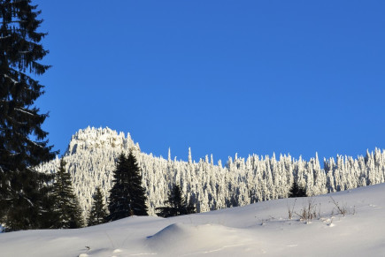
(view of Kecskekő in winter)
KERESZTHEGY HIKE
Heading west from Kecskekő and following the frequently painted red-band trail, after a moderately difficult one-and-a-half-hour walk you arrive at the large meadow on the western side of Kereszthegy peak (1,517 m). From here there is a magnificent outlook over the western ridges of North Görgény. The wooded-pasture area before us, called Bakta and Tolvajkút, is home to the highly protected Swiss stone pine (Pinus cembra). Stone pine is an excellent tonewood for musical instruments. Kereszthegy’s almost perfect conical shape sits in the centre of a large caldera; it is likely a subvolcanic body exposed by the incision of the Eszenyő, Fehér-ág and Laposnya streams.
ESZENYŐ – FEHÉRÁG – LAPOSNYA VALLEY HIKE
This route follows part of the county road between Tulghes and Reghin (an unmodernized section). Starting west from the village centre, after about 13 km by car or foot you follow the attractive valley of the Eszenyő stream and reach the Bakta saddle at around 1,200 m, which offers fine views over the southeastern part of the Giurgeu Basin. There is a forestry shelter here; below you extends a large meadow and pasture that enrich the panorama. A further 8–9 km through vast forests along the narrow valleys of the Fehérág and Laposnya streams brings you to the Laposnya forestry centre, a place of strong tourist interest. The hunting lodge of King Charles II can still be seen there, and the ruins of Regent Miklós Horthy’s mansion are also located in this area.